Friday, February 15, 2013

Close Call With Developing Ocean Storm

A rapidly deepening low pressure system will develop over the ocean tomorrow night, making a close pass at southern New England and leaving most of us with a few inches of snow by Sunday (with the potential for a lot more or nothing at all!)

As we speak, a cold front is touching off some precipitation stretching from North Carolina to New York is quickly moving to the east. Most of us are hovering around the freezing mark after our splendid day of 50 degree weather, but interior locations have cooled off faster and the rest of us will follow by early morning.

Early morning surface temps will have to be watched closely as light snow will be falling by 7/8AM. Eastern MA will see light accumulation out of this first piece of energy, with interior MA having the best chance of 2+ inches by the afternoon.

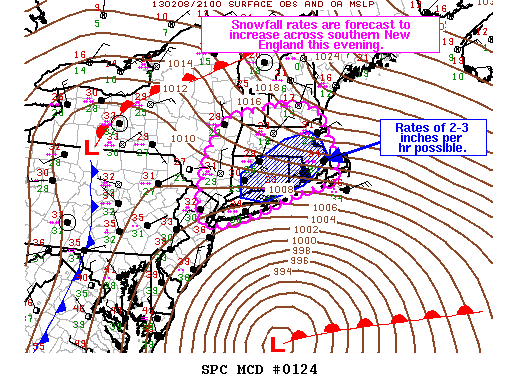
From there on, much of the action shifts to coastal MA, the South Shore and Cape Cod. Surface energy will become more focused around a developing ocean storm. This storm will deepen very quickly, bombing out in a similar fashion to our blizzard from last week. Luckily, it appears like this storm will develop too far offshore, but will still become so strong that bands of moderate to heavy snow will be thrown back our way. Maine and parts of eastern Canada are going to get crushed by this one.

This is the snowfall map that I tweeted out earlier and I still agree with it right now. Most of this snow will fall in the evening on Saturday and overnight. However, I have been saying this forecast has a high "bust" potential. As this storm is essentially developing in the upper atmosphere right over our heads, it is very hard to pin point exactly where the surface low pressure will be located come Saturday night.

The current thinking keeps this beast (potentially 950mb, which is stronger than last weeks blizzard) offshore. But the storm is not yet developed and until we begin to see this thing in person, all bets are not final. A slight shift to the west or the east of this storms development and we will be talking about big time changes to the above numbers

Stay tuned!

Tuesday, February 12, 2013

Light Snow Event Wedensday Night

After getting blanketed with over 2 feet of snow this past weekend, the last thing we need is more snow! Unfortunately, we have a pretty good chance at just that overnight on Wednesday and into Thursday. Thankfully, this snow event will be very light in nature.

Most of us will receive a general dusting to an inch, with south shore locations looking at 1-2 inches and 2-4 for the lower Cape. Precipitation should fall between 1-6AM early Thursday morning.

We remain in a very active weather pattern. I count 3 possible coastal storms for New England over the next 10 days. Cold air will pour back into the area next week, setting up a boundary and storm track nearby. Of course, way too early to know any specifics but I have a hunch we haven't seen our last winter storm of February.


Friday, February 8, 2013

Blizzard Conditions Imminent

The two systems have officially merged and our storm has been born. Currently, the powerful nor'easter is undergoing rapid intensification, a process we call "bombogenesis", which means that a mid-latitude cyclone drops in surface barometric pressure by 24 or more millibars in a 24-hour period.

IR and radar at 5PM
 Over the next 12 to 14 hours, intense bands of snow accompanied with wind gusts over 60 miles per hour. These snow bands will contain some of the most intense snowfall rates some of us have ever seen! The storm center will slowly move to the north east, eventually coming to a near stall east of Nantucket early Saturday morning.

From 10PM tonight to 10AM tomorrow morning, most locations will receive between 12-18 inches of snow! There have already been scattered reports of thunder snow over the south shore. Thunder embedded in snow bands represents the deep intensification the storm is undergoing. These are the bands that can drop snowfall at rates of 2 to 3 inches per hour.

The wind is also going to become a huge issue. Winds will continue to increase out of the north east, creating blizzard conditions with near white out for visibility. Snow drifts and blowing snow will continue to cover the roads overnight, rendering plows useless and making travel impossible

Wind Gust Forecast 4AM
Coastal flooding is also a concern, especially during tomorrows high tide at 10AM. An area extending from Newburyport all the way south to the Cape and islands, including Boston Harbor, will experience moderate to major flood levels. Loss of property is almost a guarantee.


Snowfall totals still ranging from 24-30 inches for most of the area. Truly an historic storm. Stay safe tonight!

Wednesday, February 6, 2013

Historic Snowstorm in the Making?

Get ready for Blizzard mania. As we speak, the NWS in Taunton has issued a Blizzard Watch for much of eastern MA for Friday into Saturday. It seems only fair that we finally break our snowstorm streak with a potential historic storm. There have been at least 6 storms that have just missed us over the last few weeks, many becoming quite big just offshore, leaving us with a lot of dustings. Its as if the atmosphere was teasing us. Not this time.

Let's get down to the details...

Time-frame: By early Friday morning (3-7AM) light snow should have broken out across much of the area. The snow will be light at first, but it will start to accumulate almost immediately. And the intensity of the storm will only increase throughout the day, peaking by Friday afternoon into the evening. At the storms peak, we will be talking about heavy snow and very gusty winds (20-45mph+) creating blizzard conditions, especially at the coast.

Snow Totals: This is the question everyone wants to ask. How much? In one short answer, a lot! This storm will be the result of two pieces of energy,one from the Great Lakes and one from the Gulf, phasing at just the right time, much like puzzle pieces. As is typical, a second storm will develop along the coast and travel just to the south of New England on Friday night, all the while "bombing out" and developing into a very formidable storm. This thing comes packed with LOTS of moisture and we will have the benefit of some very cold air locked into the area by the time it arrives. What this equates to is snow for everyone and a lot of it.

I think a fair estimate for snow totals would be 15-20 inches for much of MA, including Boston. With that said, it is quite likely that some areas will exceed 2 feet of snow, especially near and along 128 and 495. This storm will become so strong, it may drag in some warm air off the ocean (currently 41 degrees) to change the IMMEDIATE coast, south shore and Cape Cod to a mix at some point on Friday. However, everyone will be back into the heavy snow by Friday night as the cold air comes rushing back in as the storm reaches its peak intensity.

Needless to say, this storm is going to create quite a mess and I would expect most schools and businesses to close on Friday. The fact that the storm will only get stronger in the middle of the day makes it very dangerous to have people out on the roads.

Just under 48 hours until game time. Lots can change in that amount of time. Stay tuned for updates!


Sunday, February 3, 2013

Late Week Storm

Might we finally have a "juicy" winter storm on Friday? All winter long, we have failed to see the phasing of Gulf of Mexico moisture with the polar jet to form an ocean storm along the East coast. The reliable Euro model shows that trend might be coming to an end this week.

The above images show Thursday night and Friday morning respectively. Notice that the cold front in the first image links up with Gulf moisture to form a strong ocean storm by Friday.

Of course, this far out there is naturally some model discrepancy. The American GFS model does not show the two pieces linking up, giving us a much smaller snowfall event instead.

This one will be interesting to watch unfold this week!