Monday, December 27, 2010

Still a very strong storm


Look at our storm center as of a few hours ago. Yikes! Very strong center of circulation. Translating to some extremely strong winds on the backside of this system.

In fact, a weather buoy that sits just east of Nantucket measured an atmospheric pressure of 28.48 inches this morning!! That is a pressure level associated with a category 3 hurricane! And this mornings pressure level was just a mere 3/10ths away from an all time record in low pressure at that buoy.

Impressive stuff here. This one will go down in the record books for sure.

Its Over!

Greg is at work! What a shame! But the storm is over. It lived up to expectations for the most part. Snowfall totals were a little less than expected but overall, I ended up with just over 16 inches on my front porch.

The rest of the toatals can be found here

http://forecast.weather.gov/product.php?site=NWS&format=CI&version=1&glossary=0&highlight=off&issuedby=BOX&product=PNS

Scroll down to the wind gust details and you will see that Wellfleet on Cape Cod had a gust of 80mph at 10:52 last night!!! That is extremely strong and shows just how strong our storm got.

It is going to be windy and COLD today. Lots of blowing snow. I will have more info on the storm once I get home and away from silly work. I will say that it looks like nothern New Jersey got hit hard. Snowfall totals over 25 inches in many areas.

Sunday, December 26, 2010

Wow. Jersey is getting hit hard.

Look at these snowfall totals from New Jersey. The costal areas got HAMMERED and it is still snowing. I would expect very similar numbers from NYC, through CT and up through MASS.

Update

We are getting into some heavy snow bands now. Since about 6pm this evening, snow has picked up in intensity, banding together. Winds are really starting to whip up as well. This storm is currently sitting off the coast of Delaware and is now measured at 982 mb. This storm will continue to intensify and it will do so fast.

Because of that intensity, these heavy snow bands are going to continue well into wee hours of the morning. Dry slotting is a concern. That could hold snow totals down in certain areas. In the same regard, thunder snow might occur, which would result in huge snow totals in certain areas.

Here is our storm right now. It sure is a beast! Snow totals predictions remain the same for now.

Latest Totals

I am blogging this from work! Light snow already spreading throughout area as we speak. A little earlier than forecasted. Here are the latest QPF totals from the 12Z NAM model.

You can see that heavy band setting up right over Boston and south to Providence. Easily 20+ inches of snow in this corrider. Some spots will be higher.

The battle with the rain/snow line is important but it looks to stay all snow from Brockton northward. There is just too much cold air aloft and the winds are going to be too strong from the North to allow any mixing in the Boston area.

More updates later!

Saturday, December 25, 2010

No Joke With This Storm

It's coming folks. For snow lovers, it is a late Christmas gift. I spoke earlier about jet stream phasing and I am sure you have heard it on the news as the local meteorologists have done a good job of an explanation this time around. That phasing is occurring as we speak.

Not only that, starting about 24 hours ago, the models started to come into agreement on a storm track that really put a walloping on the east coast but specifically in Boston. That track was pretty much confirmed this afternoon after the 12Z model runs and that is when you saw the NWS put up a blizzard warning for all of eastern Massachusetts.


Look at this GFS image at 1am early Monday morning. Once this storm hits the coast, it is really going to blow up. 980mb for a low pressure system is a really deep low. That is the equivalent of a category 1 hurricane. So winds are going to be a MAJOR issue tomorrow night. I am talking sustained winds of 35 mph with gusts over 60 mph.

The snowfall rate is serious as well. With the storm passing right over Nantucket, the watch of the rain/snow line becomes important. It is a very close pass to us. Usually, you want these storms to pass south of the islands, anything closer draws in too much warm ocean air. This one will be a troublesome thing to forecast. No models can answer those questions. If the whole area stays snow, expect 12-24 inches with some towns getting close to 30 inches of snow. Yes, 30 inches. There is THAT much moisture with this storm.

But that rain/snow line will be a big factor. I suspect we stay all snow. The overnight timing helps keep temperatures down. And winds will primarily be blowing from the north east, blocking the warmer air from penetrating further inland than Cape Cod.

It starts after noon tomorrow people and it is no joke. Top 10 snowstorm of all time is likely here. The storm will be an out and out hurricane tomorrow night and blizzard conditions will be at their peak overnight into early Monday morning. Monday morning commutes will be next to impossible. Take it very seriously.

I, for one, could not be happier! This is what it is all about. Huge blizzards. This is going to be our biggest storm of the year so enjoy it.

Friday, December 24, 2010

Santa and Storms! What better way to celelbrate Christmas?

It's Christmas Eve! I hope all of you are with your families or are preparing to be with your families for tomorrow. It's the best day of the year!

Now, onto my Christmas gift. Our late weekend storm. Once again, this one is a forecasters nightmare. Now, I am not yet trained in the art of meteorology just yet, but I know enough to read some basic model maps and those models have been pretty much useless so far this winter.

This winter has been particularly difficult for all of our long range models to come into agreement on several systems. Why is this happening? I have no idea and no one does right now. I am sure the NWS will study this and give us an answer when it doesn't mean much to us.

For now, our sights should be set to the sky for Santa and then to the west and south for the beginnings of our storm. For snow lovers, you are hoping that the little piece of energy moving through the upper mid west "phases" or merges with the piece of energy over Texas that is the remnants of the last soaking storm to drench southern California.

This phasing is key. It will allow the northern jet stream and southern jet stream to merge and thus feed our storm some much needed moisture from the gulf AND tilt the upper level winds to a direction running parallel to the east coast.

The models have not come to any agreement on when if at all this phasing happens. It means everything to the track of the storm and the intensity. BUT we are starting to see a little bit of a trend. That trend brings heavy snow to SNE, overnight Sunday into early Monday. It misses the rest of the big east coast cities but nails the Boston area. QPF totals show a storm total of 0.75-1.25 inches spread over the area. Right now that would translate to a wide spread 6-12 inches with very gusty winds Sunday night.

This is likely to change. The next big model run is the GFS at 10:30. After that it is the EURO at 1am. Stay tuned!

Thursday, December 23, 2010

Storm likelyhood just got better


Latest GFS shows a big hit for us. Watch out late Sunday night into early Monday morning.

Tuesday, December 21, 2010

That snowfall was a long time coming

Boston's official snowfall total yesterday was 2.6 inches. In West Roxbury, I saw a good 4 inches on the ground. If it felt like we hadn't seen any snow in a long time, that feeling was correct.

-December 20th marks the latest date for the first measurable snowfall since January of 2000.

- Yesterdays snow broke a streak of 303 days without at least and inch of snow for Boston. The longest such stretch since we went 310 days in 2002.

So the numbers don't lie. We were well overdue.

Monday, December 20, 2010

So Maybe This Storm Didn't Miss Us Completely


Read it and weep. Or in my case rejoice. There was no lie about how big this storm was and it is showing us that strength in the form of some really heavy snow bands that have been rotating in off the ocean, specifically over Cape Cod. Down there, expect over a foot of snow with some strong wind gusts.

So what went wrong? That's what I have heard all day and will probably hear tomorrow. There really isn't a straight answer to that. This storm was huge. And it also stalled out. Both of those things were predicted. What wasn't predicted was just how heavy those snow bands became throughout the day today. This one missed us by over 300 miles and still dropped a foot of snow over some parts. That is one strong monster. Just think if it was a direct hit.


We may not be out of the woods just yet. Tuesday and Wednesday look unsettled as more snow showers are likely. From the same storm!

Sunday, December 19, 2010

So long storm 1

Almost one year ago to the day, we were bracing for our first blizzard of winter. Ultimately, the mid-Atlantic got the jackpot, with DC, Baltimore and Philly saw almost two feet of snow. We got about 10, but that's more than we will get from the storm that is about to miss us.

Last year, we ended up with 15 inches of snow in December. As of now, we don't even have a trace! Almost 1 month overdue from our first average snowfall. Those are the breaks I guess. It certainly has been cold enough and that won't change.

In the days leading up to Christmas, we will be dealing with annoying light snow that will likely not even accumulate. Map below shows the movement of our teaser storm out in the ocean. Those incraments are 12 hours and you will notice that the storm doesn't move much the next few days, actually stalling out. Just makes it more bitter sweet. This would have been a big one had it not moved east.

Not to worry! There is the possibility of another winter storm on Christmas night! The stormy pattern won't change this week and you knew it was only a matter of time before another one took a shot at us. This one looks less complicated than the first storm. There is already model agreement, but that means nothing days out.

Snow on Christmas is a nice thought though.

Friday, December 17, 2010

We are losing our big storm by the hour

The scenario seemed almost too good to be true. Polar High shifting the the west, thus lifting our storm blocking pattern. Large Low pressure system feeding into gulf moisture and then riding up the suddenly very ampliphed jet stream. Storm stalling out right off Massachusettes coast, throwing heavy snow and wind into SNE for several hours. It was suppose to be our perfect storm. And now it won't happen.

Models are comming into agreement with each run. As is the case with most of these storms, two seperate storms turn into one big one, usually right around the NC coast. Not this time. Our second guy is late to the party. Add that to an offshore track and what we have is a dud. Two semi strong storms, tracking away from the coast and then getting stuck offshore and blossoming into a big storm.

What it likely means is a long period of light snow starting late Sunday night and lasting into early Tuesday. We call this a big tease.

Still time to change this forecast, and I hope it does change. But reasoning has to trump desire here. Look for all local weather guys and gals to have a tough time forecasting this one. One slight change to timing or path can GREATLY affect the outcome. None of them want to get caught in a situation like last year where everything shut down and nothing came. I have already seen more caution with all forecasts. It appears as if that caution will win out.

Thursday, December 16, 2010

New Model Comparisons

I wish I could take credit for this great graphic, but it came from http://www.southernnewenglandweather.com/, which is a great site I just found yesterday.


Anyways, these are the 7 major models that are considered when forecasting this storm. Notice the wide range of paths even just over 3 days out. These will eventually start to look alike and that will likely be the path of the storm. Regardless of path, the storm is going to slow down significantly on Monday into Tuesday, quite possibly even stalling out. A rare occurrence for these storms but rest assured, if it is a direct hit, we are talking a long duration event with a high snowfall totals.

Nor Easter Glamour

So people, this is what it is all about. As a weather nerd, nothing and I mean nothing, compares to the buildup before a potential blockbuster snowstorm. Forget hurricanes, tornadoes and flash floods. This is where the excitement lies. It's like the buildup to the NFL draft! So much anticipation and excitement. And we all feel it, one way or another. Even the naysayers of winter, the ones who publicly wish for no snow this winter, secretly get excited for big snowstorm. If for nothing else than to have something to complain about. There is nothing like it.

Northeast snow storms have the potential to drop several feet of snow on major cities at any point in the winter. Outside of mountain storms or lake effect storms, no other area experiences anything close on such a regular basis. Need some proof? Just look at Minneapolis this past week. A modest 17 inches of snow fell in that area and caused chaos, highlighted by the freak collapse of the Metrodome. No one would ever accuse a resident of Minnesota of not being used to snow, but 17 inches in 24 hours? Just doesn't happen very often there.

I won't go so far as to call us lucky, but I will point out the uniqueness. For a region that often defines itself by its harsh weather, blockbuster snowstorms remain at the top for anticipation, drastically felt effects and everyone's favorite, bust potential. This next potential snowstorm is no different. Add to it the fact that it is the first storm of the year and would fall less than a week before Christmas and we are talking about one big attention grabbing storm.

Hit or miss, enjoy this feeling while it lasts people. It is often the best part about these things. The outcome very rarely meets the anticipation. And of course, even weather nerds hate shoveling.

Tuesday, December 14, 2010

Responding to Demands

Yes Michelle, here is your promised post. Between finals, work, Christmas and girlfriend car buying, December has been a busy month for your favorite weather blogger. Not to worry though, I am squeezing this post in between a late mac and cheese dinner and my duties as a warm blanket for a very whiny girl who is cold in bed.

So the storm chatter is heating up! But it won't heat up our temps. Another really cold day is in store tomorrow. High temps in the low 20's is just too cold for December. Remember, we aren't even into winter yet technically. And despite our below average temps for the past few weeks, we remain snow less. I think people are secretly desiring it despite what they say. The past two years, we have had a hot start to the snow fall season, with right around 20 inches falling in December. This year, nothing. Don't be fooled by these weak snow showers tonight and tomorrow night. They mean nothing.

But Sunday? Well that will mean something. Finally, a classic storm seems to be setting up for us. A low pressure system will form deep in the gulf of mexico and draw some of that moisture laden air from the gulf to form a pretty potent storm overnight on Thursday. You know the rest. That storm will track up the coast and redevelop into a stronger storm over the weekend. As you have been told dozens of times before, track means everything. There is no doubt that cold air will be in place. What is in doubt is how close the storm gets to us, when it gets to us and the new concern of will the storm be TOO strong and draw some of that warm (relatively speaking) air from the Atlantic and change us to rain along the coast.

The fact is, even the guys that get paid to do this for a living don't know. Anyone with any knowledge of weather will tell you that there is just too much time between now and the storm. Many things can change. Unfortunately, the weathermen on tv and other news outlets are forced to talk about it early because it is a potential big news story. But I bet if they had their choice, they would not mention it at all.

That being said, we all will have a better idea come Friday. That is when you will hear from me next. As it stands right now, a storm of some sort looks likely on Sunday. At least it will make for an interesting Pats game Sunday night.

Now off to bed!

Thursday, December 9, 2010

December is Good For the Moaning

We are not even into the actual winter yet and I have already lost one glove, thus making my other glove useless. I appear to be continuing my streak of losing important items in 2010 (see 2 pairs of expensive sunglasses gone).

It's too bad really because I am going to need those gloves in the coming days and weeks really. Plans to keep our apartment heat off until absolute necessity forces us otherwise has already failed. How do you not turn on the heat when the temperature bottoms out at 17 degrees overnight? Yes, 17 degrees and we aren't even at double digits yet for the monthly dates. For those of you keeping track, that is a good 13 degrees below our normal LOW temperature for this date. Ouch.

So there has to be an upside to all of this recent cold weather right? Wrong. People like me feel cold and want snow. As per usual, I will not get what I want.

Our little clipper storm that was potentially going to drop a quick 1-3 inches on us tomorrow night will actually be completely dried up by our unseasonably cold air. That's strike 1 for this cold. That big storm I briefly mentioned (or did not mention, I am too lazy to look) early this week is actually going to be "blocked" by our cold high pressure to the north and move up the Hudson Valley, in the process giving the Midwest a killer early season snow storm. We get rain. Heavy rain. And a brief warm up to 50 degrees on Sunday and Monday. Strike 2. After Monday, (almost reminiscent of an uninvited guest inviting themselves over again immediately after they just left), we get a bigger blast of cold air. And this time it will be REALLY cold. I am talking high tempertaures in the low 20's with overnight lows in the single digits to even below 0. And whats on tap storm wise for next week? Nothing. Just dry, cold, windy air. Strike 3.


Monday, December 6, 2010

Yes It is Cold

You have probably heard that from a lot of people the past few days. And you know what? They are correct. Temperatures are going to be averaging a good 5-10 degrees below normal for the next week or so. This is not what early December should feel like. In fact, this is what mid January feels like. The culprit? Take a look for yourself below. 500mb temperatures are readings from a few thousand feet up in the atmosphere but it is a crucial number since this is where all of our steering patterns, aka jet stream, reside.

It doesn't take a genius to see that a cold pool of air is just sitting over the northeast and it won't move for the next 5 days. During that period, expect just cold but sunny conditions for us here in the Boston area. Northern New England is going to get hit with a fairly potent early season snow storm, one that is actually backing into the gulf of Maine moving east to west! Ski areas will be happy for sure. Below is the expected snowfall totals, including totals from lake effect snow which will also be very active this week.

Our weather pattern gets a bit more active towards Friday night. A small little clipper system will move in during this period and could drop a quick 1-3 inches of snow over our area, with higher amounts likely in some areas. No consensus yet on how if any impact there will be but with such a strong cold air mass in place, snowfall is likely to happen at some point. Right now Friday night looks like the best shot. These clipper storms move very fast so there is no time for intensification. Anything more than a few inches of snow would be surprising.

Stay tuned and stay warm!

Wednesday, November 24, 2010

Seattle Has Our Cold Weather


This picture says it all. The northwest is stealing all of our cold weather! That deep trough has been digging in for days now out there and they are really feeling it. Seattle hasn't gotten out of the 30's for high temperatures. That never happens out there, especially not in November.

As for us, cold night tonight, moderately speaking. Temps will bottom out in the upper 20's in the city with suburban areas getting a little colder. It will be a cold start to the Thanksgiving day football games tomorrow but the good news is that there will be no wind and no rain. That is better than previous years for sure.

Thanksgiving will see our temps moderate a bit ahead of a strong storm that will track to our west overnight and into Friday. That means our winds will switch around to the southwest once again keeping us too warm for anything but rain. Rain could be heavy at times, especially early afternoon on Friday. So all of those losers who get up at 2am to shop should bring an umbrella. Map below shows expected rain and temp at 3pm on Friday.


Notice that the whole region, even areas to the far north, are above freezing. The cold air rushes back in on Saturday and Sunday but we get another warm up early next week. Unfortunately for you snow lovers, this looks to be the pattern for the near future. Warm ups followed by seasonably cold air followed by warm ups. The atmosphere is primed to give us a good winter storm, we just need the jet stream to cooperate and shift to the east and away from the Northwest. We shall see what December brings.

On a side note, Katrina and I went car shopping today. An interesting experience for both of us. I was expecting some dirt bag, sales jerk at every location. I must say that most of our sales associates were helpful and all smelled of cigarettes. I do think the whole atmosphere is funny though. No matter how many times you tell them that you are just looking for today, they try and pull every trick in the book to get you to buy at that very moment. I am sorry but no one is fooled by the "let me get my manager to cut you guys a special deal" move. None of them were too pushy though and one (the Subaru guy) didn't even try to close a deal at all, a move I definitely respected. I was just expecting that we would have to keep saying no at every dealership but Subaru took us at our word. Part of me does hate the whole car dealership culture though. I am sure all of the people who work there are fine people for the most part, but their whole vibe really made me want to punch them directly in the face. Sales people make me cringe. And this is coming from someone who technically sells something for a living. But our car shopping trip is over for the moment. Now we just have to get Katrina to be a big girl and make a decision. I told her that she should skip the SUV look and just go for a motorbike.

Friday, November 19, 2010

Chilly Night!

Even I was caught off guard with how cold it was tonight! Temps are going to settle in the upper 20's! Definitly the coldest air of the season for us, at least in the city.

Expect moderation during the day tomorrow but temps fall again on Sunday. Next week looks unsettled pretty much everyday with 3 different storms affecting us. The first is most certainly rain. (this same storm will bring some heavy lake effect snow to upstate NY) The second storm arrives just in time for Thanksgiving and most likely will start out as some heavy wet snow and change to rain during the daytime. The third storm is the most interesting one! Still too far out but it looks like a possible early season Nor Easter next weekend, with snow for most.

More to come later

Tuesday, November 16, 2010

Rainy Wednesday

Not a bad two days that we have had here. Especially compared to what we have in store for us tonight into tomorrow.

This quantitative map gives us a pretty good idea for the amount of rainfall we will see over the next 24 hours. Notice that most of the heavy stuff will stay to our west. A low pressure system will pass through the Ohio River Valley overnight and intensify as it does. What it means for us is that showers will break out overnight and be a bit spotty to being with as the atmosphere gets moist. Overnight into the late morning is where the rain will be at its worst, but as I said before, the real nasty weather stays to our west.

This storm is a quick mover and and will also quickly intensify so winds will be a bit of an issue, especially as the storm moves away during the day tomorrow. The good news is that this wind will be straight from the south, allowing us to tap into some of that southern warmth all the way from the gulf. Cloudiness will limit temps though but I think most people will take 65 degrees in November even if it is cloudy.

This one shouldn't cause too much problems since we miss the worst and what rain we do get is overnight when most of us are sleeping ( except those people that have a girlfriend with a stuffy nose who snores very loudly)

Pattern changes are coming and the weather world is all a buzz. Expect changes to our weather over the next 10-14 days. I have no more information at the moment basically because all weather models are disagreeing and no one knows what will happen. Stay tuned!

Sunday, November 14, 2010

Intersting List

A list of first snowfall dates for major US Cities via the NWS. Notice that for Boston, last years October 18th snowfall was officially very early for us. No snow in sight for now and technically we are late on our November 1st average.


Miserable Night in Pittsburgh


It looks like most of the heavy rain moved to the east of Pittsburgh but it has been raining pretty steadily all day. Apparently they don't cover their field down there, so it will be a pretty wet field. The temps will be falling all night in Pittsburgh, so it will generally be a raw, wet and cold night. And the Patriots will probably lose.

Thursday, November 11, 2010

I am Sick!

Moannnnnnnnnnnnnnnnnnnn!

Monday, November 8, 2010

Impressive Looking Storm


Take a look at this satellite picture from this morning. Quite a big storm! Classic comma shape indicates some intesification, hence our very windy afternoon!


Sunday, November 7, 2010

A Bookie's Best Friend.

That's what I am. Around Thursday of every week, I come up with a game that seems like the lock of the century. I read all of the articles, look at useless stats and make my call. How have I done? I think I have won 1 bet all year. WTF. Today was no different. Baltimore and Miami should have scored more than 41 points combined. Those bastards. Not only that, my fantasy football season is on its last legs. My team was never good, despite all of my arguing to the contrary. Its been a tough football season for Greg.

Anyways, onto the miserable weather for us. We are in for some dreary conditions over the next 24 hours. Our old storm from last Thursday actually never really went to far from us. He loves us so much that he has been hanging out near Nova Scotia and he is coming back over tomorrow! This time through the back door.


It is actually going to be cold enough over interior regions to see snowflakes. Don't expect it to stick to anything but grass and cars and also don't expect it to snow in Boston. Hilly areas in the Berkshires could get 1-2 inches of slush. But I don't know anyone that lives there. In general it will be wind, rain and cold for us all of Monday. If you know me well, this is actually my LEAST favorite type of day. When it is nearly cold enough for snow, but not cold enough to convert to cold rain to flakes. I hate it. Combined with the fact that it is a Monday, tomorrow looks to be one awful day. My advice: drink lots of coffee, avoid going outside or looking out the window and shower me with comments about how much you like my blog and how handsome I am.

The storm is slow to make an exit. Those of us on the coast will be kept in a moisture ridden air flow from the ocean pretty much through Tuesday. In fact, we will be in this type of pattern most of the week. Lots of clouds and occasional showers.

I am going to watch my favorite Sunday shows.

Saturday, November 6, 2010

Here me Moan!

Tonight, I choose to blog about non weather topics. I feel as if I am full filling my "rant" portion of this blog.

First, I am having my first age crisis of my life. I have actually felt old before this past week. Sure, I realize that I am 27. I have seen my hairline receding. I have accepted this all. But I have never actually FELT old until now. I pulled my back tonight at work. What the fuck. Who pulls there back? Even telling people that I pulled my back at work makes me feel 50. Also, a 22 year old girl recently told me that she didn't know who Punky Brewster was and that my reference was dated. What a joke. Getting old sucks. It seems like a cruel trick being played by God to have to see yourself slowly deteriorate.

Second, I love the self check outs at stores. I know that I have had tons of training scanning items in because of previous jobs and even current jobs. I breeze through it! I know how to position the barcode perfectly, I properly place my items on the weight machine, and I know how to quickly select my payment options without an hassle. I love seeing jerks struggle. That means those losers were being lifeguards or working at summer camps instead of manning the local grocery stores or CVS. That's right. My seemingly useless skills have come back to help me jump to the head of the class in self checkout. That makes me better than you.

That is all I have. I have no actual relevant weather information. I was strictly bitching. Now I have to go lie down because I threw out my back at work.

Friday, November 5, 2010

Tomas Really Soaking Hatti, Bahamas Next

Tomas, our 20th named storm of the Atlantic Hurricane season is really dropping some serious rain on Hatti and the surrounding Caribbean islands. Looking at the water vapor image below, you can really see that Tomas is the the only rain maker from the Atlantic all the way to the Rockies. And he is really using up all of that extra moisture. Upwards of 10-20 inches of rainfall in 24 hours is likely in Hatti and similar numbers probably for the Bahamas next. Wind won't be the issue with Tomas, just lots of rain!


Very quietly, this has been quiet an active hurricane season for the Atlantic. 20 named storms is a lot. But it seems so quiet to us because there was not 1 land falling storm in the US for the entire season. Odd. Nevertheless, weather nerds like myself will tell you that an active Hurricane season usually means an active winter storm season for us.

Make sure to wear your coats this weekend! It won't get out of the upper 40's for high temps all weekend!

Thursday, November 4, 2010

I am back!

I would like to welcome myself back! I won't bore you with the details of my absence, but lets just say a lack of time played a huge role. But what sort of weather aficionado would I be if I didn't get back to the grind right as the "fun" part of the weather season approaches. I know most of you don't think cold mornings and snow showers are fun but its my favorite time! This is when it gets interesting!

We have had what I would call a boring stretch of weather. A beautiful end to the summer and beginning of fall that saw us receive many sunny days, above normal warmth and just all around ideal weather for a good 5 month stretch. While I have enjoyed it, secretly I have been shaking my fist at the atmosphere. Where have the severe thunderstorms been? Where have our early season rain soaking nor'easters been? And what about an early snowfall like we saw last October?? It's crap.

Luckily, mother nature can't fight off the inevitable for long. This weekend marks daylight savings time and statistically, we have already been loosing sunlight since August at a greater rate than at any point in the year. It all adds up to a shift towards cold weather and more importantly, interesting weather!

Look at today for example. It's almost as if we are getting a little payback for our inactive period of storms. Several little storms will soak us through tonight into tomorrow. Kind of like little pests that want to get you wet. To us, it all looks the same. Just a big blob of rain. But even more interesting is the fact that on the back end of one of these storms, enough cold air will be in place to produce.........SNOW. If that doesn't get you in the mood, perhaps this image will.

Happy Thursday suckers!!!!!

Friday, September 3, 2010

Earl Didn't Have A Chance

Don't say you weren't warned. A combination of cold water, wind sheer and high latitude broke Earl apart over the past 24 hours. This kind of thing happens with Hurricanes or as Earl is now known, a Tropical Storm.

Expect heavy rain and somewhat gusty winds over the next 4-6 hours. No damage should occur, even on the once thought vulnerable Cape and the Islands. Peak wind gusts are listed at 70mph but the NWS has only observed a peak wind gust on a buoy off Long Island at 60 mph. Hardly worth a second look.

It's all over by morning. Sun will be out tomorrow and then cooler and more seasonable temps follow this week with much less humidity.

As a farewell bid to our friend Earl, take a look at this satellite image from yesterday morning, when Earl was a category 4 storm, living the good life in the warm waters off the Carolina coast.

Here is Earl as we speak right now. Notice how he is much less organized. His outer bands have spread and the front approaching from the Great Lakes. He is a shell of his former self.

Thursday, September 2, 2010

Earl Moving Further East?

The 11 pm National Hurricane Center Update looms large tonight. Indications are that right now, Earl is weakening a bit and getting pushed out further east by the developing Low pressure system in the Great Lakes.

That Great Lakes storm is the key. If it becomes more amplified, it will pick up Earl and ride him right up the coast into Nantucket. If it stays more flat, ( as seems to be the case right now) then Earl will get bumped out to sea and really not affect us much at all.

Stay tuned...

Getting Ready For Earl

My friend Pete Bouchard from WHDH sums up the approaching storm perfectly below:

1) The worst part of the storm will be between 8pm-2am on Friday night. Six hours of frenzied wind and rain - mostly along the Cape and Islands. Winds will increase FROM the northeast in that timeframe, and essentially stay from that direction until the storm pulls away.

2) Power outages are likely on the Cape/Islands.

3) Loosely secured boats may be tossed from their moorings.

4) Lots of downed trees/limbs from Plymouth to the Islands.

5) Between 1 - 6 inches of rain may fall - most of it (3-6") in southeast Massachusetts.

6) If you live far away from the coast (essentially from Andover to Concord, to Framingham and down to Foxboro and points west and north) get ready for a plain-ol' run-of-the-mill weak/mild nor'easter....that's it. The effects of this storm will be mostly felt along the coast and down through the Cape/Islands. So don't fire me an email on Saturday night and tell me I blew it and ask why you didn't get any heavy rain and downed trees and power lines. I'll just cut and paste this blog in the return email.

What to expect

While much of the discussion has revolved around the possibility that Earl MAY make landfall on Nantucket, but there is also the possibility that he may move FARTHER OFFSHORE. That is a real possibility, and one that we will watch for late tomorrow (impossible to call now). If that happens, we will ramp down on coverage and rhetoric.

Ocean swells from Earl are here! Waves will be most intense through Saturday. Beach erosion is imminent and severe. Total realignment of the sand is possible (including the expansion and formation of sand bars) on some of your favorite beaches. Although it's a great weekend to gawk at the waves, BE CAREFUL if you venture into the water. Rip currents will be strong and numerous all through Labor Day weekend.

Saving grace (if there is one) is that the storm will rocket out of here. Sun's out by Saturday morning, and the weekend looks great.


Tuesday, August 31, 2010

23 Days above 90 degrees!

And by the time we get through Thursday, it will be 25 days at 90 or above in the city of Boston. The normal value is 14 days. Certainly has been a hot and dry summer!

Watching Earl

By now, most everyone has heard the news about Hurricane Earl. Don't blame me for the over hype by the news. It is already a lead story both in the newspapers and on tv. It is still much too early for this kind of attention but naturally that won't stop the extra attention.

For now, it is still too soon to pin down an exact track. The map below shows the latest model forecast tracks as of 8PM tonight.


You can see that there is still a wide range of error. Really a difference of several hundred miles between both extreme model runs. That means that the computer models have not come to a consensus over the two main steering players.

Here is the latest hurricane center path for Earl.

The bottom line is that this is a storm that we all need to watch. There should be a better idea about what if any impact that the storm has on New England. At the very least, there will be very strong rip tides and large waves battering the coast all weekend as Earl approaches Friday night. I wouldn't be surprised if a lot of south shore and Cape Cod beaches get closed for the weekend.

Don't buy into any over hype just yet. Wait until tomorrow night, around the 11PM hurricane center update. By then, we will know if Friday night will mean heavy rainy bands and hurricane force winds or intermittent rain with just gusty winds. Stay tuned!

Monday, August 30, 2010

The Last Heat Wave of the Summer and Earl Keeps Getting Closer and Closer

Well, my string of 3 day weekend is over and I am sad. Nothing but work and school in the future for me. Yuck! The good news for most of you though is that you have one more week of summer left, with Labor Day weekend coming up. It will also feel like summer, most likely our last heat wave until next summer.

Our current surface map shows a STRONG high pressure ridge taking hold over the whole eastern half of the country. This high pressure is not going to want to move an inch from now until Thursday. What that means for us is hot temps (low 90's), sunny days with few if any clouds and low humidity. High temperatures should reach 90 or above each day of the week through Thursday, making this an official heat wave. Humidity will be nowhere near levels that it has been this summer so expect a dry but still hot heat.

Now lets talk about Earl. All summer long, we have been waiting for the tropics to heat up and now we are in the thick of it. Several tropical waves are being fed off the African coast the last two weeks and all of them have hit favorable conditions for Hurricane development. Danielle was strong, but was pushed out to sea. Earl is becoming very strong as well, sitting just north of the US Virgin Islands as we speak.

Right now, all models have Earl tracking close to the coast, but eventually going out to sea. This consensus is changing however with each model run. Earl looks to be running into a possible "doomsday" scenario for those of us on the east coast.

With our strong high pressure cemented over the east coast, another strong sub tropical high pressure system will set up over the middle Atlantic, essentially wedging Earl in the middle and allowing him to very likely ride up the coast as a strong category 3 or 4 storm as these latest model ensembles and forecast track maps show.


Nothing is written in stone just yet, but each model run is consistently bringing the storm further west and with sea surface temps running above normal all summer, it is becoming more and more likely that a strong storm will be affecting Southern New England from Friday into Saturday. This is no exaggeration. I would keep an eye on updates all week.

Tuesday, August 24, 2010

Retrograding Low Pressures!

What is this, March? Sure feels likes it. We have been stuck in a nasty easterly flow for the past 2 days and we still have one more day left. If this pattern brings back memories of early spring time, you aren't far from the truth.

A combination of an upper level low over New York state and a stalled out low pressure system just south of Nantucket is the same pattern that kept eastern Mass on the warm side of late winter storms as well as the same pattern that gave us record breaking rain in March. Think of it as mother natures way of reminding you all that she is in charge and even though this "blast from the past" sticks around for a few days, keep it in mind for our Fall and early Winter seasons. Seems like we might be seeing this again.

As for tomorrow, the Low pressure system regains strength off our coast overnight as this NAM image shows. Looks like most of the heavy precip stays offshore but this is no guarantee. Don't be surprised if we have a very similar day to today.


The good news is that after tomorrow, a STRONG High Pressure system sets up shop all of next week and brings a potential heat wave to the east coast. Summer isn't over yet!

Wednesday, August 18, 2010

Interesting Story

Nice little piece in today's Globe about how the unusually hot and dry weather is affecting local crops in both good ways and bad ways. Quite a turn around from our wet spring. It's interesting to see how the hot and dry weather helps certain crops but kills others.

By my count, since June 1st, we have had a total of 8 Sunny Saturdays out of 11 possible Saturdays. Just a little indicator of how nice the weather has been this summer.

http://www.boston.com/news/local/massachusetts/articles/2010/08/18/hot_weather_has_mass_farms_booming/?page=1

Wednesday, August 11, 2010

Don't Miss The Perseides Meteor Shower!

If you get a chance, from now until Friday night, there should be some great viewing of the Perseids meteor shower. We are in a New Moon phase as well, so no moonlight pollution. Clear skies should help the cause as well. Just make sure you get outside of the city lights somewhat for the best viewing. The following is a greatexplanation from the Harvard Smithsonian Center for Astrophysics

The Perseids are certainly the best known, if not the most active, meteor shower of the year. The experience of watching them, however, can vary widely. Of course the local weather can make or break a shower viewing, but it's important to keep in mind that the shower occurs not just on the nights of the peak (August 12-13) but for several nights before and after. It's possible to see some Perseids as soon as July 23 and as late as August 24. Another factor is the presence of moonlight; here, prospects for the 2010 shower look favorable indeed, with a New Moon occurring just a couple of days before the peak. The Perseids happen when Earth's orbit around the Sun brings our planet in contact with debris streams left by the periodic comet 109P/Swift-Tuttle. The shower profile depends on the location and density of the debris streams - a factor that is beyond our control but increasingly predictable. What IS in our control is the time of night we choose to observe (after midnight is best) and our location (a site with dark skies is preferred). Under ideal conditions this year, the Perseids should be spectacular!

Tuesday, August 10, 2010

Its Official, It Has Been Hot and Dry This Summer


From the NWS:

- The intense heat either tied, or shattered, July monthly temperature records in several East Coast cities. Washington D.C. recorded an average temperature of 83.1 degrees F, which tied with July 1993 as the warmest for any calendar month on record. Other July monthly temperature records were broken, or tied, in Atlantic City, N.J. and Hartford, Conn.

- It was the hottest July on record for Delaware and Rhode Island. Along the East Coast, each state from Maine to Florida ranked in their top 10 warmest. Only Montana, Idaho, and Texas had below-normal average temperatures for the month.

- The May-July period was the warmest on record for the Northeast and Southeast climate regions and was the ninth warmest for the Central region. This period produced record warmth for: New Hampshire, Massachusetts, Rhode Island, New Jersey, Delaware, Maryland, Virginia, North Carolina, and South Carolina. The Northwest had its sixth coolest May-July period. Below-average temperatures were experienced in Oregon (fifth coolest), Idaho (seventh), and Montana (eighth) during the same period.

- Wisconsin had its second wettest July, while Texas had its fourth, Iowa its fifth, and Missouri its eighth. By contrast, it was the 10th driest July for Georgia and Virginia.

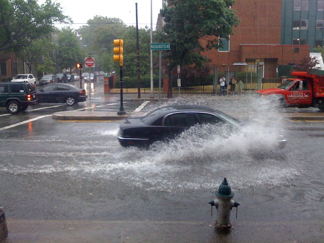
- Much of the Plains and Upper Midwest experienced above normal precipitation, triggered by moist tropical air that fueled widespread thunderstorms. Several of these systems stalled out and caused major flooding in some areas.

- Precipitation, when averaged across the nation, was much-above-normal, ranking as the 10th wettest May-July period. On the regional level, much of the northern tier United States was above normal. The East North Central had its second wettest May-July. Both the Central and West North Central region had their ninth wettest and the Northwest had its 10th.

- Precipitation was well below normal in Louisiana for the year-to-date period (January-July), as drought conditions continued to deteriorate. The state was more than 9.5 inches below the long-term average for the year, its seventh driest such period in 116 years. Conversely, Iowa was nearly 10 inches above average, its third wettest start to the year.

Tropics Heating Up


It's been a fairly quiet tropics season in the Atlantic so far, but favorable conditions and abnormally warm ocean temperatures could change the outlook rather quickly. As for now, there is a tropical depression that has recently formed in the Gulf. Not much expected from this storm as it won't have much time to deepen. It will likely turn into a Category 1 storm before making landfall east of New Orleans. Just heavy rain and minimal wind damage.


Here is the current Atlantic ocean temps and areas of tropical interest.


Sunday, August 8, 2010

Humidity Starts Off A Stormy Week


A slow moving cold front will linger over our area for the beginning of the week keeping us in the humidity for the first few days.

On another note, the Codzilla boat in the harbor is a lot of fun but they do have a stupid skit that should probably be dropped. Katrina sure did have a good time and a lottttttttt of drinks!

Tuesday, August 3, 2010

Check Out The Northern Lights!

Aurora Alert: The Sun is Waking Up!
Cambridge, MA - Sky viewers might get to enjoy some spectacular Northern Lights, or aurorae, tomorrow. After a long slumber, the Sun is waking up. Early Sunday morning, the Sun's surface erupted and blasted tons of plasma (ionized atoms) into interplanetary space. That plasma is headed our way, and when it arrives, it could create a spectacular light show.

"This eruption is directed right at us, and is expected to get here early in the day on August 4th," said astronomer Leon Golub of the Harvard-Smithsonian Center for Astrophysics (CfA). "It's the first major Earth-directed eruption in quite some time."

The eruption, called a coronal mass ejection, was caught on camera by NASA's Solar Dynamics Observatory (SDO) - a spacecraft that launched in February. SDO provides better-than-HD quality views of the Sun at a variety of wavelengths.

"We got a beautiful view of this eruption," said Golub. "And there might be more beautiful views to come, if it triggers aurorae."

When a coronal mass ejection reaches Earth, it interacts with our planet's magnetic field, potentially creating a geomagnetic storm. Solar particles stream down the field lines toward Earth's poles. Those particles collide with atoms of nitrogen and oxygen in the atmosphere, which then glow like miniature neon signs.

Aurorae normally are visible only at high latitudes. However, during a geomagnetic storm aurorae can light up the sky at lower latitudes. Sky watchers in the northern U.S. and other countries should look toward the north on the evening of August 3rd/4th for rippling "curtains" of green and red light.

The Sun goes through a regular activity cycle about 11 years long on average. The last solar maximum occurred in 2001. Its latest minimum was particularly weak and long lasting. This eruption is one of the first signs that the Sun is waking up and heading toward another maximum.

Thursday, July 29, 2010

So Many Sharks!


No wonder. Our ocean temps are averaging a good 2 to 4 degrees above normal. Specifically in Falmouth, Chatam and south facing beaches.

Woods Hole current sea temperature 74. Normal for July 29th 72.

Bo
ston current sea temperature 69. Normal for July 29th 67

Two degrees is a lot for the ocean. Sharks sure do like warm water. So do Hurricanes.


Tuesday, July 20, 2010

No Tornado

From the NWS......

...THERE WAS NO TORNADO IN WORCESTER COUNTY ON JULY 19...

A NATIONAL WEATHER SERVICE TEAM SURVEYED THE TOWN OF ASHBURNHAM
ALONG WITH ADJACENT PORTIONS OF WESTMINSTER AND GARDNER TODAY.
VERY LITTLE IN THE WAY OF DAMAGE WAS EVIDENT FROM THE STORMS THAT
MOVED THROUGH THAT AREA YESTERDAY AND THE CONCLUSION IS THAT NO
TORNADO REACHED THE GROUND.

Monday, July 19, 2010

I am back and there is a tornado warning!


Live from my new residence in West Roxbury, where my legs and arms are tired from moving and biking to work, but more importantly, there are some severe storms rumbling through our area tonight!

They may have taken all day, but it was worth the wait. Right now, there is a tornado warning our for northern Worcester county. The radar was showing some "very impressive vorticity and reflectivity images" as stated by the NWS at 7:30. No confirmation yet, but we will wait to see if a tornado actually did touch down! Here is the radar image.

No tornados for us here in Boston. The air overhead is too stable. Look for these storms to weaken as they get closer to the coast.

Monday, July 12, 2010

Welcome to Monday, Where I am Moving Shit All Day

After round 1 of my moving boxes from Somerville to West Roxbury, I am....
- Completely soaked after an early afternoon t-storm(more on that later)
- Sick of the radio, especially sports radio.
- Pissed that someone invented elevation and stairs.
- Appalled at how many freaking books and other items Katrina has.
- Intrigued by the day time crowds in and around the city. Freaks don't just come out at night.
- So close to getting my new phone! But then Sprint stepped in and fucked it up. Classic.
- Growing more and more happy with the decision to get an apartment with laundry in it.

That is all I got for observations. I was impressed with the storm that soaked me. I guess that easterly breeze was strong enough to cause some serious lift in the atmosphere and produce some nice downpours. Over a half inch in Cambridge. More elsewhere I am sure.

This instability is great. Reminds me of Florida. Humid and moist airflow everyday, clashing with seabreezes and topography to make for some true pop up thunderstorms. It's with us for the rest of the week for sure. Expect downpours at any time really.

That's it for me right now. I am eating lunch, being lazy, then off to round 2 of moving crap( mostly Katrina's crap)

Hopefully I will get my 5 day up again later today. I was having some technical difficulties last night.

P.S. If you can get to the beach, do it! Ocean temps are very warm right now, 70's pretty much everywhere. That is pretty warm for us in July! I would not be surprised if there are some more shark sightings with ocean temps this warm.

Sunday, July 11, 2010

What A Wet Saturday Afternoon

So yesterday was quite a show! Around 2:30 in the afternoon, some heavy rain moved into the greater Boston area and sat over us for about an hour. The atmosphere was VERY moist, almost 100% humidity. Combined with some very unstable air you get heavy downpours!

In Cambridge, where I was at work, 3.3 inches of rain fell in just under 90 min! Boston got 2.01 inches in the same time span. We hadn't had any rain here for the better part of two weeks so our ground soil was very dry and unable to absorb this amount of rain in such a short time. What you got was scenes like these.


Thank you to my friend Brian Blank for the pics. Crazy scene! I saw a little kid get swept off his feet by the strong current of water on Mass Ave. Some pretty serious flash flooding was reported all across the area. Once the rain stopped, the floods just disappeared. Makes you think though. If just 3 inches of rain could do this, what does 8 or 9 inches of rain look like!

By the way, our yearly total for precipitation is over 30 inches now! We still have 5 more months in the year as well.

Friday, July 9, 2010

Friday is here and I have the afternoon off

Moving sucks. Katrina and I are slowly packing up our things and transitioning to our new place. Most people say that having more time to move is a good thing, but I think it leads to more procrastination. All in all, I give moving 7 yucks out of 10.

So I have decided to scrap my website version of this blog for awhile. It is too much work to maintain both and lets face it, I have no idea how to build and maintain a website. I think the blog is good enough for now. I will build on some features here instead, like the 5 day forecast that I just posted! Go ahead and tell me it looks awesome. I know it does. Honestly, tell me anything. I am dying for comments. No one comments and it makes me sad.

But lets get to the good stuff! It sure is humid out today. As I write this, the temperature is only 91, but the dew point is 65. Dew points of course measure the amount of moisture in the air. 60s to 70s for dew points are just uncomfortable and the air feels heavy. We are not near our record temperatures of earlier this week, but if you ask me, more humidity is worse.

A slow moving cold front is going to impact our weekend. Ahead of it, we are stuck in the humid airflow from the southwest. This front is going to be a slow mover. Everything is a bit log jammed in our atmosphere right now, mainly due to the big high pressure ridge over the east coast. This front is the same one that basically ran into another stalled cold front over the mid west earlier this week. Now it is dragging its feet through our region.

The front never makes it to Boston on Saturday, but because of our warm and moist air, showers and heavy rainfall could really pop up at any moment in the afternoon. Either way, expect more clouds than sun as the day progresses. Overnight, more steady rainfall will move in with some chance for thunderstorms as well.

Until then, have a great day. I give this day a sweat factor of 8 out of 10.

Custom 5 day!!!


Wednesday, July 7, 2010

Nachos!!!!!!!

Sorry about the title. I just finished my nachos from last night for breakfast and now I am regretting it.

So I don't know about anyone else, but last night I could not sleep at all. It was too hot and I could feel the humidity too. Heat indexes were in the upper 80's to 90 degrees as late as midnight last night! That is not fun. Katrina was excited to have the bed all to herself, but Mr. Pink Nose was not happy that I disturbed him in the living room. I guess I just can't win.

Excessive heat will still be persistent in interior sections of the state today as well as in the mid atlantic region. Cities like Washington DC, Baltimore and Philly could easily top 100 degrees for the second straight day. For Boston? We have a nice onshore flow today that will keep us in the relatively cool 90's.

Our high pressure ridge begins to break overnight and cooler temps with higher humidity will follow.

Tuesday, July 6, 2010

100 Degrees!

In the midst of baby watching today, the city of Boston hit 100 degrees for the first time since 2002! The "expected" sea breeze never really developed. I knew we were in trouble when I left for work at 9:45 this morning and we were already at 91 degrees with a strong southwest breeze in Somerville. Still, 100 degrees for this city is a big deal.

Look for some relief tomorrow in the temperature department, but humidity will be on the rise as the week progresses.On a side note, how cute is my new niece Mackenzie??

Welcome to Tuesday, Where its Hot and I am an Uncle!!


Hottest day of the year? Check
Katrina angry that she is not at the beach? Check
My sister having her baby and me becoming an uncle? Check!

What a day. I hope most people are on vacation this week because it is going to be quite hot today as I am sure most of you are aware by now. The NWS has issued a heat advisory for pretty much all counties in the state. Suffolk county was a late inclusion in the advisory, trumping earlier thoughts that an afternoon seabreeze would keep temps down a bit.

Temperatures should easily reach 95+ today combined with dew points in the mid to upper 60's. This will make it feel like 100-105 degrees for several hours today.Yuck!

Stay inside if you can. No need to be a hero today. With our third straight day of 90 degree heat, we officially have our first heat wave of the summer. I am not sure we even got one heat wave last summer.

Humidity will be on the rise overnight, so uncomfortable sleeping conditions are expected. That means it is ok to sleep naked! Haha.

Tomorrow and beyond, we lost the hot temps somewhat, but we trade that off with higher humidity. Anyway you cut it, its going to be a hot week.

Make sure you visit my website! www.northeastweatherrants.com

Friday, July 2, 2010

The Heat Is On


Get ready New England. We are about to enter our first heat wave of the summer. And this one could be here for several days.

Tomorrow the transition begins. Expect temperatures to climb into the upper 80's with increasing humidity. After that, the heat parade begins. Our summer time buddy, the Bermuda High, slips a little further west over the next few weeks, driving the northern jet stream way up into Canada and keeping us in a very warm and humid south, southwest flow. This pattern, much like cold air patterns that we get in the winter, will be tough to break and we are looking at temperatures in the mid to upper 90's, even in Boston, for pretty much all of next week. Obviously, things can change later in the week, but expect 90+ degree heat with humidity starting July4th and lasting through Tuesday. This much I can promise you.

This heat wave will not be pleasant. Humid conditions will make it unbearable at times. The mid atlantic big cities could get the worst of it, with temps hitting 100 degrees likely in DC and even Philly. At least we won't get that hot. Try to stay cool!

July Snow!!!


Check out this picture from Mt. Washington this morning!

Our cool air mass the past few days really had an extreme effect on top of the 6000+ foot mountain. Morning time temps in the mid 30's allowed for a dusting of snow to fall up until about noon today. Pretty stark contrast to our weather down here and even more of a contrast to what is coming. At 35 degrees, Mt. Washington holds the distinction of being the lowest temperature recorded in the lower 48 today.

Thursday, July 1, 2010

June Data

Average Daily Temp 70.3

Departure from Normal 2.3

Highest Temp 94

Lowest Temp
53

Total Precipitation for Month 3.18

Total Precipitation for Year 28.98

Departure from Normal 7.85


Wednesday, June 30, 2010

Wednesday Equals Dry Air

Waking up this morning, it is noticeably cooler. Last night was the first time in over a week that we did not need to leave the AC on overnight, which is good for my electric bill and for my hot and furry kitten. Dew points right now are in the 40's! That is quite an air pattern change.

We have a beautiful day set up today. Temps in the upper 70's, low humidity and a slight west breeze will set up some spectacular weather. This is what the weather in heaven would feel like.

Tonight, our dry airmass and lack of cloud cover will allow temps to drop off pretty quickly. Some outlying areas could even fall into the upper 40's! Pretty cool for the last day of June.

SUNRISE: 5:10AM
SUNSET: 8:25PM
LENGTH OF DAY: 15h 14m

NORMAL HIGH TEMP: 80
RECORD HIGH TEMP: 95(1945)
YESTERDAYS HIGH TEMP: 91


Alex was officially upgraded to a hurricane overnight, albeit a weak category 1 hurricane. Expected landfall should occur sometime tomorrow afternoon in Mexico. The combination of slow forward movement over very warm Gulf waters could allow for some rapid intensification but it is doubtful that the storm will produce winds over 100 mph.

Lastly, remember to visit my website today at www.northeastweatherrants.com and enjoy the cool weather. The rest of the country is boiling!

Tuesday, June 29, 2010

Tuesdays Thumbnails

Welcome to Tuesday! And nearly the end of the month.

Our cold front continues to pretty much sit on top of us and because of this, scattered storms are in the forecast again. Yesterday, much of the instability and action was focused to the south of the Boston area. Massachusetts south coast and the Providence region saw some pretty strong storms pass through around dinner time. Not expecting the same strong storms today, but since we are still on the tropical and humid side of the front, there will be the threat of some isolated severe storms later in the afternoon.

Once the cold front moves through, much cooler and drier air will follow. Until then, expect temps to reach the low 90's again with dew points maxing out in the 70's. Another hot and humid day is on tap.

Take a look at the great month of weather that we have had!
http://www.wunderground.com/history/airport/KBOS/2010/6/29/MonthlyHistory.html#calendar

We have our first tropical system of the season, Tropical Storm Alex. Alex looks to make landfall right around the Texas/Mexico border as a Cat 1 hurricane.


And last but not least today, check out my new website www.northeastweatherrants.com! I will continue to write my blog, but there will be more exciting features to come on the website!! Check it out today.

Thursday, June 24, 2010

Welcome to Thursday, Where Big Storms Await

Fear not. Our warm, humid air is only with us for a few more hours. Morning time cloud cover will gradually give way to hazy sunshine, causing our atmosphere to heat up and become instable! This means the potential for strong storms exists anywhere between 3 and 8 this afternoon. Expect severe thunderstorm watches to be posted sometime soon.

The strong cold front will be moving through our region fairly slowly and because of this slow movement,the Boston area and other coastal areas will have the best chance to heat up before hand. Combine that with a very strong southwesterly flow and extremely strong winds aloft and you get very strong storms to develop close to the water, which of course is unusual. The sea breeze typically cuts of development of these summer storms as they approach the coast,but that will not be the case today. The I95 corridor could actually see the worst of the storms.

As always, be aware of any warnings posted. These storms could be the strongest of the season for the Boston area. We should start seeing the squall line approach the city around 4 or 5 this afternoon. Torrential raindfall, strong wind gusts and lots of lightening should be expected.

The good news is that after this, we get a beautiful, dry day tomorrow!

Wednesday, June 23, 2010

I am back! And it's hot

So my apologies for being absent for so many days. A combination of the Celtics, work and laziness is to blame. On the subject of the Celtics, I was disappointed with the outcome, but proud of the effort. It was a hell of a run, but the Lakers were the better team and not by much. I am hopeful that this playoff run will convince Doc to come back (although I am fine with McCale) and enough for Ray to be resigned along with some other small parts for one more run.

As far as the weather goes, summer is now upon us as of Monday! The longest day has passed but the weather remains excellent. We really have had a wonderful stretch of weather for over a month now, nothing compared to our wet and cool June of last year.

We have yet to see some real extended summer heat. We have had some bouts with humidity and even some severe thunderstorms, but for the most part, we have avoided some of the extreme heat that can be associated with summer.

Onto today. A dry and humid airmass is making its way to us as we speak. A west, southwest flow will keep us dry and dew points will be on the rise. Expect temps to approach 90 degrees, even at the coast, with dew points boarding on uncomfortable.
No thunderstorms today as our air, at all levels of the atmosphere, is just too dry.

With that said however, there may be some storms moving through northern areas of our region overnight. Tomorrow, a low pressure system passes near the Canadian border and actually increases the southwest air flow. That means even more hot and humid conditions than today. It will be somewhat windy too.

Keep those AC's on and make sure your kittys and pups have plenty of water!!!!